Project
Assisting Plant Design with AI Technologies
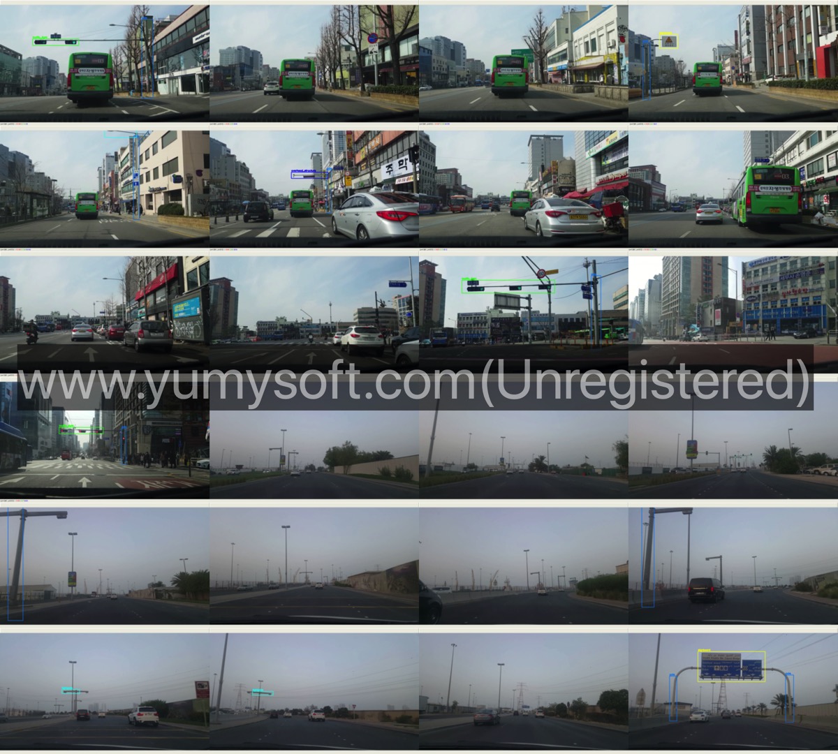
Obstacle Height Extraction
From the video of dashboard camera, the height of the obstacles along the plant transportation route can be extracted. The network used for this is YOLO, and this research primarily focused on post-processing the bounding box data.
Plant Transportation Information Analysis System
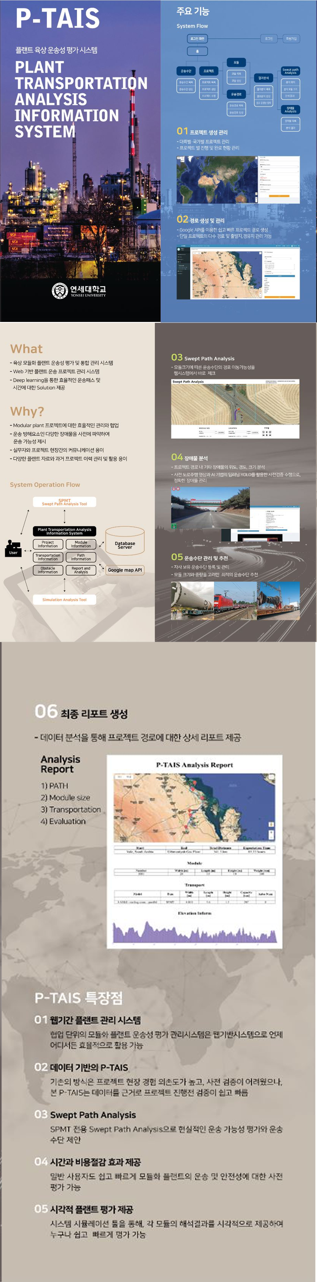
This is a single-page web application for the management of plant transportation projects over land. Google Maps APIs are extensivelly used. The main challenges were interative data binding with HTML forms, Google Maps, JavaScript, and database.
- Back-end: PHP, NodeJS
- Database: MySQL
- Front-end: jQuery, JS Render, Bootstrap